This post is more than 19 years old
Politics move quickly and opinions evolve. There's a good chance I no longer hold some of the opinions expressed in the post below
—Mustapha
Hezbollah’s Tent City, Now On Google Earth
September 16, 2007 · Mustapha Hamoui
Google announced that it had new Hi-Res images for various countries including Lebanon (Hat tip Taq). It includes one place in particular that will not enjoy the limelights.
Remember those grumpy bouncers outside Hezbollah’s tent city who wouldn’t allow you to take pictures? They won’t be happy about this at all. The tent city will now be part of the Lebanese official Google Earth map many years into the future.
(You can see it online in Google Maps here, or in case you prefer using Google Earth, download this kml file and double click on it. It will immediately open Google Earth and take you there)
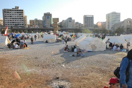
Alright, this last photo wasn’t from Google Earth but you get the picture.